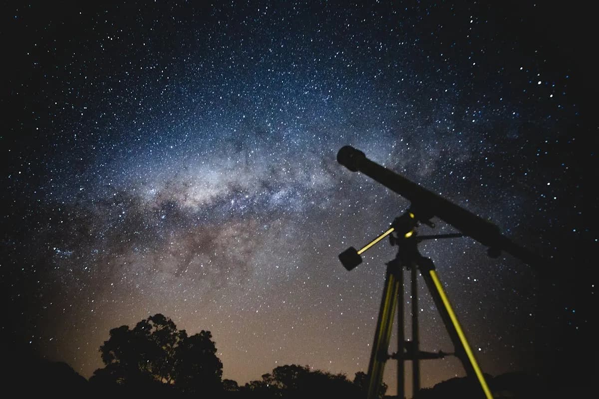
What is a star map?
A star map is a scientifically accurate representation of the night sky as it appeared — or will appear — from a specific location on Earth, at a given date and time. It is generated from the real positions of 8,921 stars drawn from the HYG v4.2 astronomical catalog (which merges data from the European Space Agency's Hipparcos mission, the Yale Bright Star Catalog, and the Gliese Catalog), covering any date between 1900 and 2100 and any point on the globe. Star positions are calculated using the official algorithms of the International Astronomical Union (IAU), the same formulas used by professional observatories and planetariums worldwide.
In practical terms, a star map answers one question: which stars were above my head at that moment, from that place? It sits at the intersection of astronomy and emotion — every dot on the map is a real star at its real position, and together they form a unique snapshot of the cosmos for a moment that belongs to no one else.
How does a personalized star map work?
Behind the beauty of a star map lies a chain of astronomical calculations. Here is how the process works, step by step.
The starting point: your coordinates
Everything begins with three pieces of information: a date, a time, and a location. These three parameters are enough to define a unique sky among billions of possible configurations. The location is converted to latitude and longitude, and the date into a universal time reference.
The star catalog
Star positions come from the HYG v4.2 catalog, an astronomical database that brings together three reference sources:
- Hipparcos — Data from the European Space Agency's satellite, launched in 1989 and operational until 1993. Hipparcos measured the positions of over 118,000 stars with a precision on the order of a milliarcsecond — roughly a thousand times better than ground-based observations of the era. It forms the backbone of positional accuracy.
- Yale Bright Star Catalog — The reference census of the brightest stars in the sky, maintained by Yale University since 1930.
- Gliese Catalog — Complementary data on stars near our solar system, within a radius of 25 parsecs (about 82 light-years).
From the catalog's 120,000+ stars, only the 8,921 stars of magnitude 6.5 or brighter are retained — the theoretical visibility threshold of the human eye under ideal observing conditions.
Sidereal time calculation
The Earth rotates on its axis in 23 hours and 56 minutes (the sidereal day) while orbiting the Sun. The result: at two different times from the same location, you see different stars. To determine which portion of the sky is visible, the algorithm calculates the Local Sidereal Time in three steps:
- The date and time are converted into a Julian date — a continuous day count used in astronomy since the 16th century, which eliminates all calendar complications.
- From the Julian date, the Greenwich Mean Sidereal Time (GMST) is calculated according to IAU formulas, accounting for Earth's axial precession.
- The observer's longitude is added to obtain local sidereal time.
Coordinate conversion
Every star in the catalog has equatorial coordinates: right ascension and declination. These are "absolute" coordinates — they do not change with the observer. Sirius is always at the same position on the celestial sphere.
But what matters for your map is the local view: which stars are above the horizon, and where are they in your sky? The algorithm converts equatorial coordinates to horizontal coordinates (altitude and azimuth) using spherical trigonometry, the observer's latitude, and the local sidereal time. Stars with a negative altitude — below the horizon — are excluded.
Stereographic projection
The sky is a hemisphere. A poster is flat. To bridge the two, the map uses a stereographic projection — a mathematical technique used in celestial cartography since Hipparchus of Nicaea in the 2nd century BCE.
The stereographic projection has two properties that make it ideal for star maps: it preserves angles (so constellation shapes remain recognizable) and it maps circles to circles (so the horizon remains a perfect circle on the map). The center of the map corresponds to the zenith — the point directly above your head.
The final rendering
The 88 official IAU constellations are drawn by connecting specific pairs of stars, using the segment data found in professional planetarium software. The Milky Way is rendered from a density map of the galactic disk. The result: a star map that faithfully reproduces what you would have seen looking up that night.
For a deeper technical explanation, see our article on the algorithms behind star maps.
What does a star map show?
What it shows
- Stars visible to the naked eye — Up to 8,921 stars of magnitude 6.5 or brighter, with their size on the map reflecting their actual brightness. Sirius (magnitude -1.46) appears significantly larger than a magnitude 6 star.
- The 88 IAU constellations — The lines connecting stars to form traditional figures: Orion, Ursa Major, Cassiopeia, Scorpius, and 84 others. These are the constellations officially recognized by the international astronomical community since 1928.
- The Milky Way — The diffuse band of our own galaxy, whose appearance varies considerably depending on season and location. A summer sky in the Northern Hemisphere features a spectacular Milky Way stretching across the heavens.
- The horizon circle — The boundary between the visible sky and the ground. Everything inside the circle was above the horizon at your date and time.
What it does not show
- Planets — Mercury, Venus, Mars, Jupiter, and Saturn are visible to the naked eye, but their positions are not included. Unlike stars, whose positions are virtually fixed on the celestial sphere, planets constantly move along the ecliptic, and including them would require a separate planetary ephemeris calculation.
- Deep-sky objects — Nebulae, distant galaxies, and star clusters are not plotted (with the exception of the Milky Way itself). Although a few are visible to the naked eye (such as the Andromeda Galaxy or the Pleiades cluster), they are not part of the standard rendering.
- Artificial satellites — The International Space Station or Starlink satellites, while sometimes visible, are not plotted. They are fast-moving objects, not celestial bodies.
- The Moon and the Sun — Their positions are not shown, although their presence (or absence) influences what the human eye actually perceives of the night sky.
Star map vs. birth chart vs. planisphere
These three objects share a connection to the sky, but they are fundamentally different. Here is a factual comparison.
| Star map | Birth chart (astrological) | Planisphere | |
|---|---|---|---|
| Basis | Astronomy — scientific data | Astrology — symbolic interpretation | Simplified astronomy |
| Data | 8,921 real stars from the HYG catalog | 10 celestial bodies (Sun, Moon, planets) | Fixed constellations |
| Customization | Specific date + time + location | Date + time + place of birth | Fixed latitude, adjustable date |
| Shows | Stars as they actually were in the sky | Symbolic positions of planets in zodiac signs | Constellations visible on a given date |
| Purpose | Commemorative, decorative, educational | Personality interpretation, predictions | Sky observation tool |
| Scientific accuracy | Verifiable (Stellarium, etc.) | Not applicable — symbolic framework | Approximate (manual rotation) |
| Format | Digital or printed poster | Circular diagram with 12 houses | Physical rotating disk |
To be clear: a star map is not an astrological tool. It says nothing about your personality, your future, or your romantic compatibility. It shows the stars as they were arranged in the sky, full stop. That is astronomy, not astrology.
That said, astrology and astronomy share a common root — the observation of the sky by ancient civilizations. A birth chart uses the same mathematical fundamentals (celestial positions at a given moment) but interprets them within a symbolic framework. If that resonates with you, that is your prerogative — but know that an OwnStarMap star map deals purely in science.
A planisphere, meanwhile, is a practical observation tool: a rotating disk that shows which constellations are visible at a given latitude for any date of the year. It is generic — not customized for a specific date and location — and it does not display individual stars with their real brightness.
Why give a star map as a gift?
People who give star maps share a common motivation: turning a moment that matters into a lasting, beautiful object. Here are the most common occasions, and what makes the gesture so meaningful in each case.
The day a child is born
When a baby arrives, the sky above the hospital is unique. Parents who order a birth star map are not just decorating the nursery — they are creating a time marker. "These are the stars that welcomed you." Twenty years later, that child can look at their map and see the exact sky of their first night. It is a birth poster that never expires.
A wedding or engagement
On the night of a wedding or a proposal, the sky is the silent witness. A star map of that night turns an abstract memory into a tangible object. Many couples hang it in their living room with the location and date inscribed beneath — not as a museum piece, but as a daily reminder.
A wedding anniversary
Whether it is a paper anniversary (1 year), silver (25 years), or golden (50 years), revisiting the sky of your wedding day decades later carries deep emotional weight. The couple has changed, life has moved on, but the stars of that night remain the same.
A tribute
After the loss of someone close, some people choose to capture the sky of the night they were born or the day they left. It is a quiet, personal tribute — not a monument, but a presence on the wall that says: "You were here, under these stars."
Other moments
The evening of a first meeting. The night of moving into a new home. The day of a graduation or a retirement. Any moment worth marking can become a star map. What makes the gift unique is that it is not generic: it is tied to a specific instant in the recipient's life.
How to verify a star map's accuracy
You do not have to take our word for it. The advantage of a star map based on scientific data is that it is verifiable. Here is how.
Step by step with Stellarium
- Download Stellarium — It is a free, open-source planetarium program, available at stellarium.org. It is used by amateur and professional astronomers worldwide.
- Set the location — Enter the same city (or the same GPS coordinates) as on your star map.
- Set the date and time — Enter the exact date and time.
- Compare the constellations — Verify that the same constellations appear in the same regions of the sky. Orion should be in the same place, Ursa Major as well.
- Check the horizon — Stars below the horizon in Stellarium should not appear on your map. If they do, the horizon filtering is not working correctly.
- Spot the bright stars — Sirius, Vega, Arcturus, and Capella should be in the same relative area in both representations.
Automated verification
At OwnStarMap, our algorithms are covered by 238 automated tests that compare calculation results against known reference values. Every code change is verified against these tests before going to production. This is not a marketing claim — it is standard software engineering practice, the same rigor applied to mission-critical software.
For more detail, our article on star map accuracy walks through every link in the precision chain.
How to create your star map
The process takes less than five minutes.
- Open the design tool — Go to ownstarmap.fr/design. No account needed.
- Enter your date, time, and location — The tool auto-recognizes over 50,000 cities and places worldwide. The sky is calculated in real time as you type.
- Customize the design — Choose the color theme, poster shape, typography, and add a personal message (title, subtitle, location and date).
- Download or order — The digital file is available instantly. Print formats are also offered.
The real-time preview shows you all 8,921 stars and 88 constellations repositioning with every change. Shift the time and watch the sky rotate. Change the location and see different constellations appear. It is interactive astronomy.
Frequently asked questions
Is a star map a horoscope?
No. A star map and a horoscope have nothing in common, despite the apparent link to the sky. A horoscope falls under astrology: it symbolically interprets the positions of the Sun, Moon, and planets to derive predictions or personality portraits. A star map falls under astronomy: it shows the real positions of stars, calculated from scientific data measured by satellites. No interpretation, no predictions — just the sky as it was.
How many stars appear on a star map?
Exactly 8,921 stars, filtered from the 120,000+ in the HYG v4.2 catalog. This number corresponds to stars of magnitude 6.5 or brighter — the limit of human eye visibility under ideal conditions. For comparison, some providers display only 3,000 to 5,000 stars, producing an unnaturally sparse sky. Others include tens of thousands, rendering the map unreadable. Our 8,921 stars reproduce the sky as your ancestors saw it, far from any light pollution.
Can I create a star map for a future date?
Yes. The astronomical engine works for any date between 1900 and 2100. You can create a star map for an upcoming event — a planned wedding, an expected birth, a future birthday. Star positions are calculated with the same precision as for past dates, because the fixed stars do not shift perceptibly over a few centuries (their proper motion is imperceptible at human timescales).
Are star maps a good gift?
Yes, and what sets them apart from other personalized gifts is the combination of three qualities: they are unique (no two moments in time produce the same sky), they are meaningful (tied to a specific memory), and they are lasting (a poster that hangs on a wall and is looked at for years). It is a gift that resonates with astronomy enthusiasts and people who simply appreciate a thoughtful gesture alike. For occasion ideas, see our gift occasions guide.
What is the difference between a star map and "naming a star"?
They are radically different things. Services that offer to "name a star" sell a certificate assigning a custom name to a star — but no official scientific body recognizes these names. Not the IAU, not NASA, not any observatory in the world. It is a purely commercial operation. A star map, by contrast, is based on real astronomical data: the 8,921 stars displayed are real stars, at their real positions, from a catalog used by scientists. For a detailed comparison, see our article star map vs. naming a star.
Are all star maps the same from one site to another?
No, and the differences can be significant. The quality of a star map depends on the star catalog used, the precision of the calculation algorithms, the type of cartographic projection, and the number of constellations drawn. Some providers use simplified catalogs with a few thousand stars, projections that distort constellation shapes, or approximate constellation lines. Others fail to filter the horizon properly, displaying stars that were actually below the horizon line. Our star map site comparison analyzes these differences in detail.
Ready to capture your special moment?
Create a personalized star map in minutes.
Design my Star Map — from ~$13.87